Goroka
Goroka is the capital of the Eastern Highlands Province of Papua New Guinea. It is a town of approximately 19,000 people (2000), 1600 m above sea level. It has an airport (in the centre of town) and is on the "Highlands Highway", about 285 km from Lae in Morobe province and 90 km from the nearby town of Kainantu also in the Eastern Highlands. Other nearby towns include Kundiawa in Simbu Province and Mount Hagen in Western Highlands Province. It has a mild climate, known as a "perpetual Spring".
It is the home of several national institutions: CRMF Christian Radio Missionary Fellowship, the PNG Institute of Medical Research, the National Film Institute, the Liturgical Catechetical Institute, the Melanesian Institute, the Raun Raun Theatre Company and the University of Goroka. Several NGOs also have presences there, including Oxfam and Save the Children. The town's single largest hotel is the Bird of Paradise, owned by the Coral Seas Hotels chain.
Coffee is a common cash crop in the area; smaller industries include trout farms, pigs, bee keeping and food gardens (broccoli, kau kau or sweet potato, carrots, ginger and peanuts are examples of produce that grow well here; nearby Bena Bena is known for its pineapples).
In May, Goroka hosts the PNG Coffee Festival.
The Goroka Show event takes place annually around the time of the country's Independence Day (September 16). It continues for two or three days. The Goroka Show is the oldest show in Papua New Guinea, over 50 years of "keeping the spirit alive".
Map - Goroka
Map
Country - Papua_New_Guinea
 |
 |
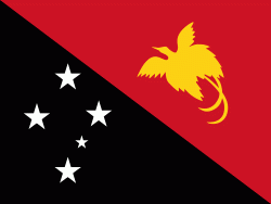
| Flag of Papua New Guinea | |
At the national level, after being ruled by three external powers since 1884, including nearly 60 years of Australian administration starting during World War I, Papua New Guinea established its sovereignty in 1975. It became an independent Commonwealth realm in 1975 with Elizabeth II as its queen. It also became a member of the Commonwealth of Nations in its own right.
Currency / Language
| ISO | Currency | Symbol | Significant figures |
|---|---|---|---|
| PGK | Papua New Guinean kina | K | 2 |
| ISO | Language |
|---|---|
| EN | English language |
| HO | Hiri Motu language |


